

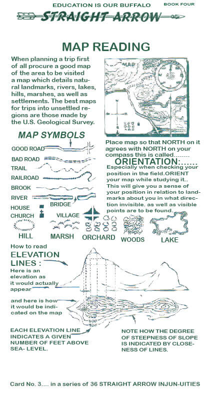
Indian maps and mapping abilities have been reported in a variety of sources, however due to their ephemeral nature, there are comparatively few Indian-created maps left today. Indian-drawn maps, as well as evidence of their contributions to European-drawn maps, are valuable and rare documents for researching Indian peoples’ geographic knowledge and social awareness. European explorers frequently sought out indigenous peoples to lead them or provide geographical information about new places, and Indian guides were frequently employed to provide reconnaissance data for military and commercial purposes. Responses to requests for geographic data were occasionally presented in a graphical manner.When planning a journey, get a decent map of the area you’ll be visiting, one that shows natural landmarks, rivers, lakes, hills, marshes, and settlements. The geographical survey’s maps are the finest for expeditions into uncharted territory. Orient your map while studying it, especially while checking your position in the field. This will give you a sense of your position in respect to land markings around you, as well as in what direction invisible and visible points are to be located.